
General Project Information
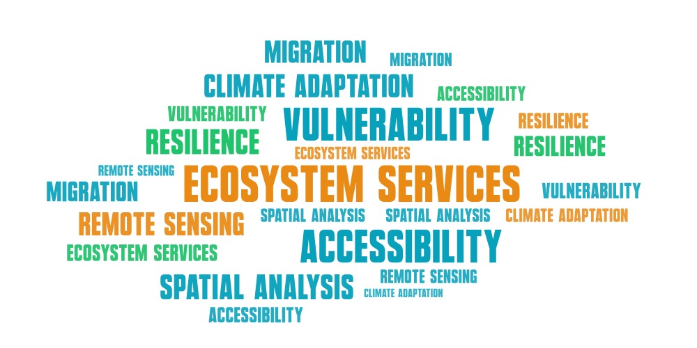
ECO-ARISE focuses on analysing the interrelations between environmental change, infrastructure, and human mobility in selected regions of East Africa. ECO-ARISE develops an innovative decision-support tool to monitor ecosystem services and their relationship to population migration in regions experiencing rapid environmental and climate changes. The project integrates satellite data, participatory mapping, and social research to analyze how environmental degradation or restoration affects human mobility and well-being. By combining remote sensing, local knowledge, and data on public services and natural resources, ECO-ARISE creates a comprehensive framework to support governments, NGOs, and development organizations in designing sustainable land management and climate adaptation strategies.

The project builds on the existing ARICA Online Geoplatform and extends it with new analytical tools and datasets relevant to ecosystem monitoring and accessibility analysis.
Project Objectives
- Identifyecosystem service changes – Analyze areas where ecosystems are degrading or being restored using satellite data, focusing on water availability, agricultural land fertility, forest resources, and access to clean water.
- Assess accessibility and vulnerability – Map how population groups reach essential ecosystem services and public facilities (healthcare, education) under current conditions and under hazards such as droughts, floods, fires, or conflicts.
- Link environment to migration patterns – Understand how environmental changes and infrastructure availability influence human mobility decisions, particularly rural-to-urban movement in East Kenya and the impact on social fabric and resilience.
The project aims to deliver a geospatial decision-support tool that reveals interconnections between ecosystem health, infrastructure quality, and population well-being. This enables evidence-based planning at local, regional, and global scales.
Workflow Overview
ECO-ARISE operates through six coordinated work packages (tasks) combining Polish and German research teams:
Data & Research Foundation (WP1–2 / Polish & German Partners)
- Polish researchers conduct interviews and participatory mapping with local communities in rural and urban areas of East Kenya to understand how people perceive environmental change and migration drivers.
- German partners deploy the SketchMap tool, allowing local communities to map ecosystem services and infrastructure on paper, which is then digitized and georeferenced.
- Satellite imageries and Street View data are collected to assess road quality, a key indicator of accessibility.
Analysis & Indicators (WP3–4 / Polish & German Partners)
- Multispectral satellite imageries (Sentinel-1/2) are processed to detect ecosystem degradation, fire zones, and flooding areas.
- Accessibility indices are computed to determine which populations can reach services (healthcare facilities, schools) and natural resources (water, firewood) within acceptable travel times.
Vulnerability & Resilience (WP5–6 / German-Led)
- Natural hazards (floods, fires) and conflict data are integrated into accessibility models to identify at-risk populations.
- Future scenarios are simulated (population growth, infrastructure development, climate impacts) to support long-term planning.
Platform & Dissemination (WP4 / Polish-Led)
- Results are combined and published on Geoplatform – upgraded and modified version of ARICA Geoplatform - web-based tool for visualizing ecosystem service status, accessibility, and migration patterns.
- User needs are documented; commercialization pathways are explored.

Area of Interest
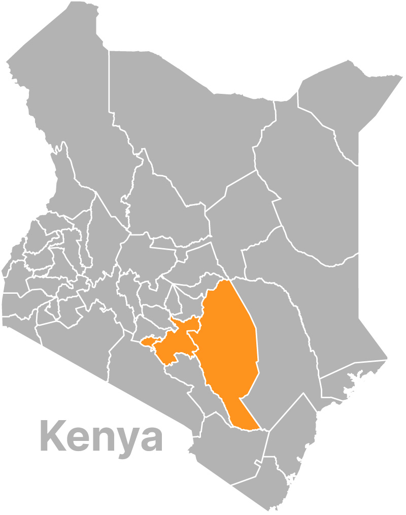
ECO-ARISE focuses on East Kenya, specifically the counties of Masinga, Yatta and Mwala in the dryland regions, and the urban settlement patterns of Nairobi, including informal settlements ("slums"). This region experiences high population dynamics driven by climate variability, rural-to-urban migration, and ecosystem degradation. The semi-arid landscape is vulnerable to droughts, which stress water and pasture availability, triggering livelihood crises and human movement.
East Kenya is representative of many Global South regions facing similar challenges: rapid urbanization, climate change impacts, ecosystem service decline, and growing pressure on public infrastructure. The methods and tools developed in Kenya are designed to bescalable and adaptable to other African and global regions with comparable environmental and demographic pressures.
Intended Outcomes & Impact
Direct Products
- Ecosystem Service Maps: Raster layers identifying areas of degradation, stability, and recovery in water access, agricultural land, and forest cover.
- Accessibility Indices: Datasets showing which populations can reach healthcare, education, water sources, and firewood within different travel times and distances.
- Vulnerability Index: Spatially-explicit assessment of how natural hazards and conflicts reduce accessibility to essential services and ecosystems.
- Upgraded and modified ARICA Geoplatform: User-friendly web tool integrating all analyses, enabling government agencies, NGOs, and researchers to monitor ecosystem change and accessibility in real time.
Decision-Support Impact
The tool supports targeted interventions: identifying underserved populations, prioritizing infrastructure investment, planning climate adaptation, and anticipating migration pressure. It enables early warning for resource bottlenecks and supports humanitarian response planning.
Scientific & Policy Contribution
The project advances methodologies for integrating remote sensing with social research, bridging the gap between environmental and social sciences. Results contribute to international platforms (UN, World Food Programme, European Commission, GEO group) for evidence-based development and climate action.
Scalability & Sustainability
Tools and protocols are freely available, enabling replication in other regions. The ARICA platform's architecture supports long-term updates and adaptation to local needs.

